



No Mountains, but Plenty of Hills.
Denmark has no mountains. It also has no shortage of hills – and I’ve spent years walking the difference.
I’ll admit it: I get a little envious. On a clear day in Norway, the horizon stacks up in layers of blue. In Sweden, the forests run on past the point where your eye gives up. We Danes have neither. No peaks, no ranges, no wilderness you could get genuinely lost in.
And yet here’s the thing I keep coming back to. Denmark isn’t nearly as crowded as many – both foreigners and Danes, assume. We sit at roughly 140–142 people per square kilometre – a country of just over six million, spread over about 43,000 km². Compare that with England at over 400, the Netherlands above 500, and Belgium, Germany and Italy well up the list too. We are a modern, wealthy, industrialized nation with some of the most intensive farming in Europe – and still, twenty minutes outside of most towns, you can be standing in a field with no one in the frame but you.
Flat as a pancake – mostly true.
Geologically speaking, the old saying holds up. Our highest natural point, Møllehøj in East Jutland, tops out at a distinctly un-dramatic 170.86 metres. That’s the lowest “highest point” of any country in Europe that has one. For decades Danes believed it was Himmelbjerget – “Sky Mountain” – until proper measurement in 1847 cut it down to 147 metres and broke a few hearts. It wasn’t until 2005 that Møllehøj was officially confirmed as the winner, edging out Ejer Bavnehøj and Yding Skovhøj by a matter of centimetres.

So: no mountains. But the Ice Age left us something better suited to walking.
The ice did the sculpting.
The last glaciers didn’t flatten Denmark – they kneaded it. Moraine landscapes, kettle holes, steep-sided valleys and rounded ridges were pushed up and carved out as the ice retreated thousands of years ago, and you can read the whole story underfoot.
My favourite of these is Mols Bjerge National Park, on the Djursland peninsula about half an hour from Aarhus. It’s often called Denmark’s hilliest corner, and it earns the name: Agri Bavnehøj at 137 metres, Trehøje’s Bronze Age burial mounds, deep glacial pits, and – improbably – around a quarter of Denmark’s conservation-worthy habitat types and roughly half its wild plant species packed into one small area. Sand lizards sun themselves on the slopes. You walk up through beech and heather, and the sea keeps appearing and disappearing behind the ridges.

Further west, the Vejle valley country gives you the same sensation in a softer key: river, forest, and hills that make your calves file a complaint. South of Copenhagen, Stevns Klint is something else entirely – a 15 km white chalk cliff, UNESCO-listed, where you can put your hand on the layer of rock that records the asteroid impact that ended the dinosaurs. Nearby Møns Klint rises 128 metres above the Baltic in seven kilometres of raw white chalk, UNESCO-listed as recently as 2025, with the rolling Høje Møn hills behind it.
And then there’s Bornholm, out in the Baltic. Rugged granite coast in the north, powder-white sand in the south, and in Almindingen one of Denmark’s largest forests with Rytterknægten – 162 metres – rising out of it. The whole island is served by a coastal path of more than 100 km that circles it, along with fishing villages, smokehouses, and four medieval round churches.
The coast is the real mountain range.

If I had to explain to a visitor what makes Danish walking special, I’d say this: we traded altitude for coastline, and we got the better end of the deal. Denmark has more than 7,000 km of coastline – and considerably more if you measure it in detail – and more than 400 islands, not even counting the smallest sandbars and islets. Wide beaches, coves, bays, fjords.
The Limfjord cuts across the north of Jutland, all small bays and sandy shore, hills sloping down to the water. Further south along that west coast, wide beaches give way to the Wadden Sea — UNESCO-listed tidal flat.

Walking on the old paths.
Some of the routes are older than Denmark itself. Hærvejen, the Ancient Road, ran down the Jutland spine for centuries – cattle drivers, pilgrims, traders – and today the hiking trail stretches more than 600 km, from Hirtshals and Frederikshavn in the north to the German border, where it continues as the Ochsenweg. It hooks up with St. Olav’s Way in Norway and, further south, with the routes to Santiago de Compostela. You’re not walking a trail; you’re walking a piece of infrastructure that predates the nation.
Gendarmstien follows the Flensburg Fjord for 84 km along an old border-guard patrol path – coastal forest, quiet coves, the sound of water the whole way. Øhavsstien, the Archipelago Trail, threads around 220 km across southern Funen and the islands, hopping ferries between Ærø, Lyø and the rest. Camønoen does a Danish Camino across Møn, 175 km. And the newer Gudenå Trail runs 19 stages along Denmark’s longest river, past monastery ruins and old barge routes.
The islands, and why I keep going back.
I’ve spent a lot of Danish summers on ferries, and I’ve never regretted one. Each island has its own character.

Samsø is Denmark in miniature, exactly as the brochures claim: 114 km² with steep coastal slopes, hilly farmland, glacial gullies, a Viking-era canal hand-cut through its narrowest point, and beaches that are never crowded.
Ærø has cobbled streets and the best-preserved medieval town in the country. Læsø has seaweed roofs, long sand beaches and lobster. Fanø sits in the Wadden Sea with the North Sea on one side. Femø has 35 km of public paths and not much else to do, which is the entire point.
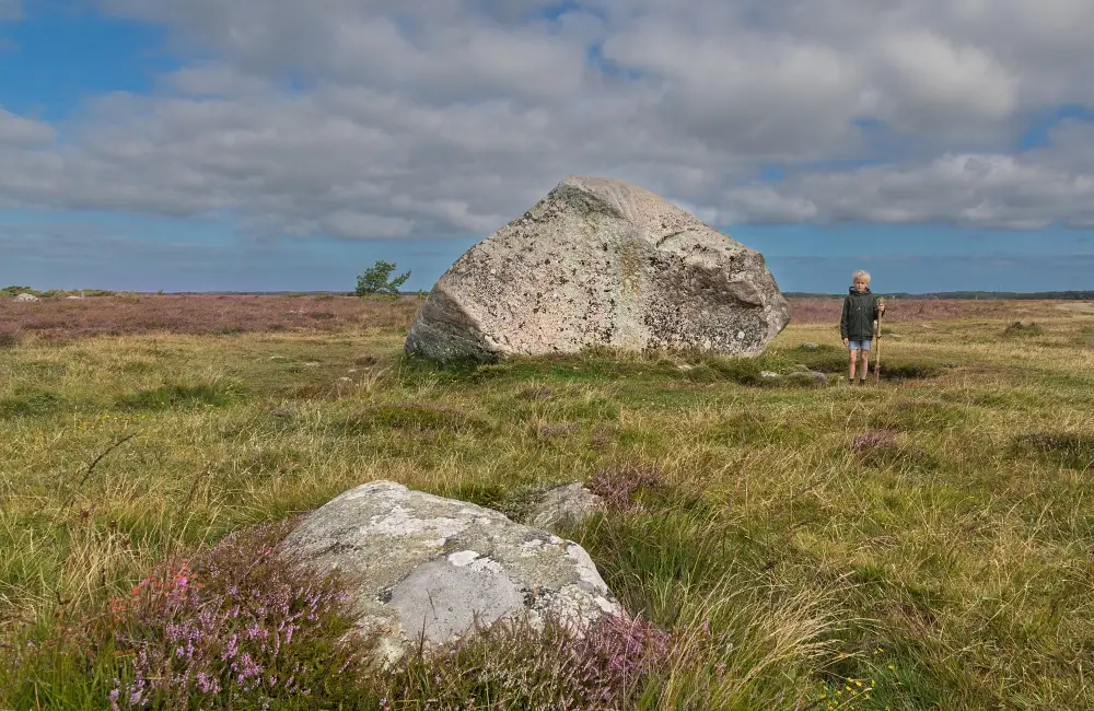
What you actually get.
I won’t pretend the views here are alpine. But I’ve lost count of the times I’ve stood on a Danish hilltop – calves aching, wind coming off the water, a line of beech trees bent in one direction – and forgotten for a moment that this is a country without mountains.
